 vesseltracker.com
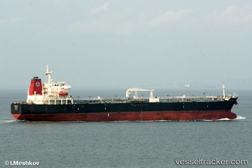
Vessel ELIZABETH M IMO: 9308156, MMSI: 538010194 Crude Oil Tanker
UTC, -22.86181, -43.12949, course: 301, speed: 0
UTC, -22.86181, -43.12957, course: 301, speed: 0
2026-02-09 10:06:56 UTC, -22.86167, -43.12833, course: -1, speed: 0
Live AIS position:
UTC. Near NITEROI),
updated 2026-02-09 10:06:56 UTC.
Find the position of the vessel ELIZABETH M on the map. The latter are known coordinates and path.
marine traffic ship tracker show on live map
The current position of vessel ELIZABETH M is -22.86167 lat / -43.12833 lng. Updated: 2026-02-09 10:06:56 UTCCurrently sailing under the flag of Marshall Islands
ELIZABETH M built in 2007 year
Deadweight:
50359 tDetails:
Last coordinates of the vessel:
UTC, -22.86189, -43.12948, course: 301, speed: 0UTC, -22.86181, -43.12949, course: 301, speed: 0
UTC, -22.86181, -43.12957, course: 301, speed: 0
2026-02-09 10:06:56 UTC, -22.86167, -43.12833, course: -1, speed: 0